")
")
")
From the small port of Cannero a beautiful paved road climbs up to cross the state road: the panoramic view of the village of Cannobio is remarkable. Cross the main road and continue on a beautiful mule track that climbs steeply through a beautiful forest and then continues halfway up to Carmine Superiore, with its church of San Gottardo. From this medieval village you can also enjoy a wonderful glimpse of the Castelli di Cannero. After passing the crossroads for Viggiona, you will reach Molineggi, a small village whose name and numerous finds tell of the activity of ancient mills. From here the descent to Cannobio begins, passing through Solivo. The mule track comes out on the carriage road of the Cannobina valley, follow it for a few tens of meters in the direction of Cannobio and take the cycle/pedestrian path that reaches the park in the locality of Amore. From here you have to go down to cross the state road and, taking the paved road, you will reach the beautiful lakefront that you have to follow up to the area of the lido and the sports field. Following the cycle path that goes around the sports field, you will come to an underpass that allows you to cross the state road. Immediately afterwards you have to go up the ramp that reaches the bridge of the state road which you have to follow on the sidewalk continuing for about 500m up to the locality of Darbedo. Here begins a beautiful mule track with hairpin bends that goes up to Campeglio. From here the beautiful mule track continues halfway up the woods of oak and chestnut trees to reach the characteristic village of Cinzago with an unusual bell tower with a triangular section. Still on a beautiful mule track, continue up to the church of San Bartolomeo in Montibus, a small treasure in the woods, built in the thirteenth century and dedicated to San Bartolomeo Apostle. From the church continue halfway down to Formine and finally you will reach San Bartolomeo, the last hamlet of the municipality of Cannobio before the state border.
THE ROUTE:
Via delle Genti
THE LEGS OF THIS ROUTE:
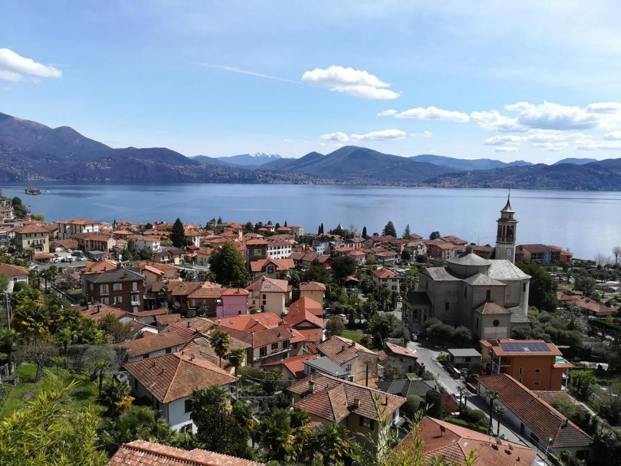
Via delle Genti - Leg 1: Intra - Cannero Riviera
Notable Items along the Track
Cannobio is the last town on the Piedmontese shores of Lake Maggiore before the border with Switzerland. Due to its geographical position, it represented an important strategic and commercial node which is still well represented by the presence of numerous buildings of the seventeenth - nineteenth centuries that overlook the cobbled streets and streets of the historic center, such as the sixteenth-century residence of Palazzo Omacini and Palazzo Pironi. The Borgo is awarded the Orange flag of the Italian Touring Club and has been recognized by FIAB as "Bicycle Municipality". Each hamlet of Cannobio has small oratories: characteristic is that of Cinzago for the particular triangular section. The church of San Bartolomeo in Montibus is also a small peaceful eden in the woods.
POUT_ACCESSO_LABEL
Cannero can be reached via the A26 highway, Verbania exit, then Strada Statale 34 del Lago Maggiore
Accesso con mezzi pubblici
The local railway station is Verbania Pallanza. From the station, buses depart for Intra, Cannero, Cannobio, Confine di Stato (for timetables www.vcotrasporti.it). The same line is used for the return. The navigation service is also active in the ports of Intra, Ghiffa, Oggebbio, Cannero and Cannobio with the possibility of returning by boat (For boat timetables visit the website www.navigazionelaghi.it)
link-utili-label