")
")
")
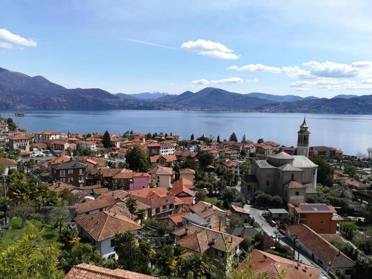
The stage starts from the Verbania Intra pier. Follow the lakeside in a northerly direction and immediately before San Giovanni stream, cross the state road and take Via Brigata Cesare Battisti which leads to the cycle/pedestrian walkway. After crossing the stream, take via Selasca, a beautiful internal road with limited traffic that runs alongside the parks of large villas and leads to Selasca. After passing a stone bridge, take the mule track that begins to climb, alternating stretches of asphalt, until it crosses the carriage road that leads to Susello (Corso Dante Alighieri). From Susello, take the mule track that goes up to Ceredo, where, in correspondence with the Oratory, a wide, almost flat path starts, which soon becomes a dirt track that reaches the Sacro Monte di Ghiffa. After visiting the monumental complex, the path continues and descends to the small village of Deccio. From here the path begins to rise in the thick of the woods and then descends to Novaglio. Continue for a short stretch on the carriage road then take the old mule track that cuts the hairpin bends and goes down to Camogno. The route continues flat on beautiful internal lanes to Cadevecchio to emerge in a parking lot at the top of the town. From here, continue following the carriage road that climbs to Travallino. Just before a crossroads indicates the possibility of descent to Pieggio, Spasolo and the tourist port of Oggebbio. From Travallino continue along the carriage road (Antonio Manzi street) along a cemetery until you reach Gonte, domicile of the Municipality of Oggebbio. Continue along the Strada Panoramica road, passing through the beautiful nucleus of Cadessino with the oratory named Santa Maria or Madonna della Misericordia, built between the 13th and 14th centuries on the site of a pre-existing 11th century church of which the bell tower remains. Following the road you will reach Barbé Superiore which you have to cross to visit the oratory dedicated to San Bernardo da Mentone and then you have to rejoin the carriage road at a hairpin bend. Here you have to take the stepped path that becomes a beautiful mule track and which descends to cross the stream on a beautiful stone bridge and goes up to Ponte, the first hamlet of Cannero Riviera. From the parking area, follow the road and soon you will reach Cassino. From the central square starts the path which climbs steeply with hairpin bends to the hamlet Frazione Donego from which you can enjoy a beautiful panoramic view. After crossing the whole village, take the beautiful paved mule track that gradually descends towards Cannero. Reached the state road, it is better to cross it and continue for secondary lanes, then go along the town hall, go up to cross the stream on the pedestrian bridge and finally descend along the narrow streets of the town to the port of Cannero.
THE ROUTE:
Via delle Genti
THE LEGS OF THIS ROUTE:
Via delle Genti - Leg 2: Cannero Riviera - San Bartolomeo
Notable Items along the Track
Bell tower of the Basilica of San Vittore (Intra). Basilica Sacro Monte of the SS. Trinity of Ghiffa. The Sacro Monte di Ghiffa, together with other Sacri Monti of Piedmont and Lombardy, was declared in 2003 by UNESCO as a World Heritage Site. It is a complex of baroque order, dedicated to the SS. Trinità, immersed in a grandiose natural environment and dense woods. Cannero Riviera has typical characteristics of the Mediterranean coastal resorts: the natural inlet that shelters it from cold winds and the sunny position favor the growth of lush vegetation, rich in cedars, lemons, olive trees, orange trees, palms, azaleas, rhododendrons and camellias, very well known. The Borgo is awarded the Orange flag of the Italian Touring Club.
POUT_ACCESSO_LABEL
Verbania Intra can be reached via the A26 highway, Verbania exit, then Strada Statale 34 del Lago Maggiore
Accesso con mezzi pubblici
The local railway station is Verbania Pallanza. From the station, buses depart for Intra, Cannero, Cannobio, Confine di Stato (for timetables www.vcotrasporti.it). The same line is used for the return. The navigation service is also active in the ports of Intra, Ghiffa, Oggebbio, Cannero and Cannobio with the possibility of returning by boat (For boat timetables visit the website www.navigazionelaghi.it)
link-utili-label