")
")
")
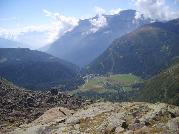
This trail runs along a stretch of the ancient Via dell’Arbola, paved with old cobblestones as its sharp turns rise from Goglio, clearing a crossing through a steeply inclined rock ridge which seems impassable at first. Without giving in to the comfort of paved roads or cars, the true climb to the Alpe Devero clearing begins here.
The itinerary starts in Goglio at the fork in the road for Devero. First, follow the mule track that flanks a tall avalanche protection wall, continuing on until it intersects the wide mule track that connects Goglio and Devero. Turn right and take the diagonal path that will bring you just below the rocky face of a cliff. From here, the pretty, wide mule track begins a difficult climb in a channel with infinite sharp bends then crosses the pressurised water conduits. It subsequently arrives at Forcola, a cluster of ruins with a chapel, and a trail that connects to the car park near the first tunnel. One last sequence of hairpin bends, and the climb finally ends. Continue the pleasurable walk along the plains until reaching the car park for Alpe Devero and then the alpine plain itself. Once you’ve reached the small church of the village (the hamlet of Ai Ponti), turn left, flanking the Buscagna River, cross the wooden bridge and continue until the chalets (baite) of the town of Pedemonte. Walk along the comfortable dirt track, pass an isolated baita (Alsone) and arrive at the drain outlet for the hydroelectric power plant. Proceed by flanking the peat bog near the hamlet of Giavina until coming to the Rifugio CAI Capanna Castiglione mountain hut in the town of Cantone. Continuing along the packed earth track, you’ll return to the front of the small church of Devero.
The ring route along the Devero plain has informative panels and a few interactive sensory installations.
Last update: 06/03/2018 ore 15:55:46


