")
")
")
This excursion, reserved to trained excursionists, offers an exclusive scenery on the glaciers of Adbola and Dei Sabbioni. Up to the 1970s the front part of the glacier used to enter the Lake and it was possible to see blocks of ice floating in the lake’s waters. From the 3A Mountain Hut an Alpine path crosses what remains of the Siedel Glacier and descends directly onto the Chamois’ Plain.
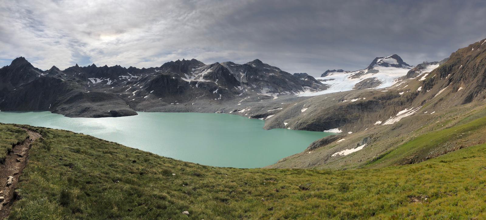
Starting from the parking lot under the Morasco Dam we follow a small road which goes up to the dam and coasts the lake. From the beginning of the cableway we take the path towards the Bettelmatt Alp, we cross the torrent on a small bridge made out of old pipelines and we go up until the fork in the road. Here we take a left towards the Great Sands Lake and via a steep path we go back up to the Shepherd’s Hut. We go slightly downwards until we cross the small torrent and go back up the great valley via high-altitude not very well-marked prairies up to the Rifugio Mores at the Great Sands Lake. We go down crossing the dam, and then carry on to the left while entertaining a great view of Arbola and Hosand and then go up to the Claudio Bruno Mountain Hut.
From here onwards via a last uphill stroll in this mountainous environment we reach the 3A Mountain Hut. From the mountain hut it is possible to go down directly to the Chamois’ Plain along the snow which covers what remains of the Chamois’ Glacier: this is a demanding tract which is only reserved to good connoisseurs. It is recommended to take the path back to the Great Sands Lake Dam along the same path taken upwards. From here we can cross a wide track which goes back up to the Chamois’ Plain where we reach the Città di Busto Mountain Hut.
From here a comfortable and wide hairpin bends path descends down the Bettelmatt Alp, where the renown Bettelmatt cheese is produced, and then, following the Gries Way (Via del Gries), we go back to coasting the Morasco Lake up to the starting point.
Last update: 06/03/2018 ore 10:18:25


