")
")
")
General features:
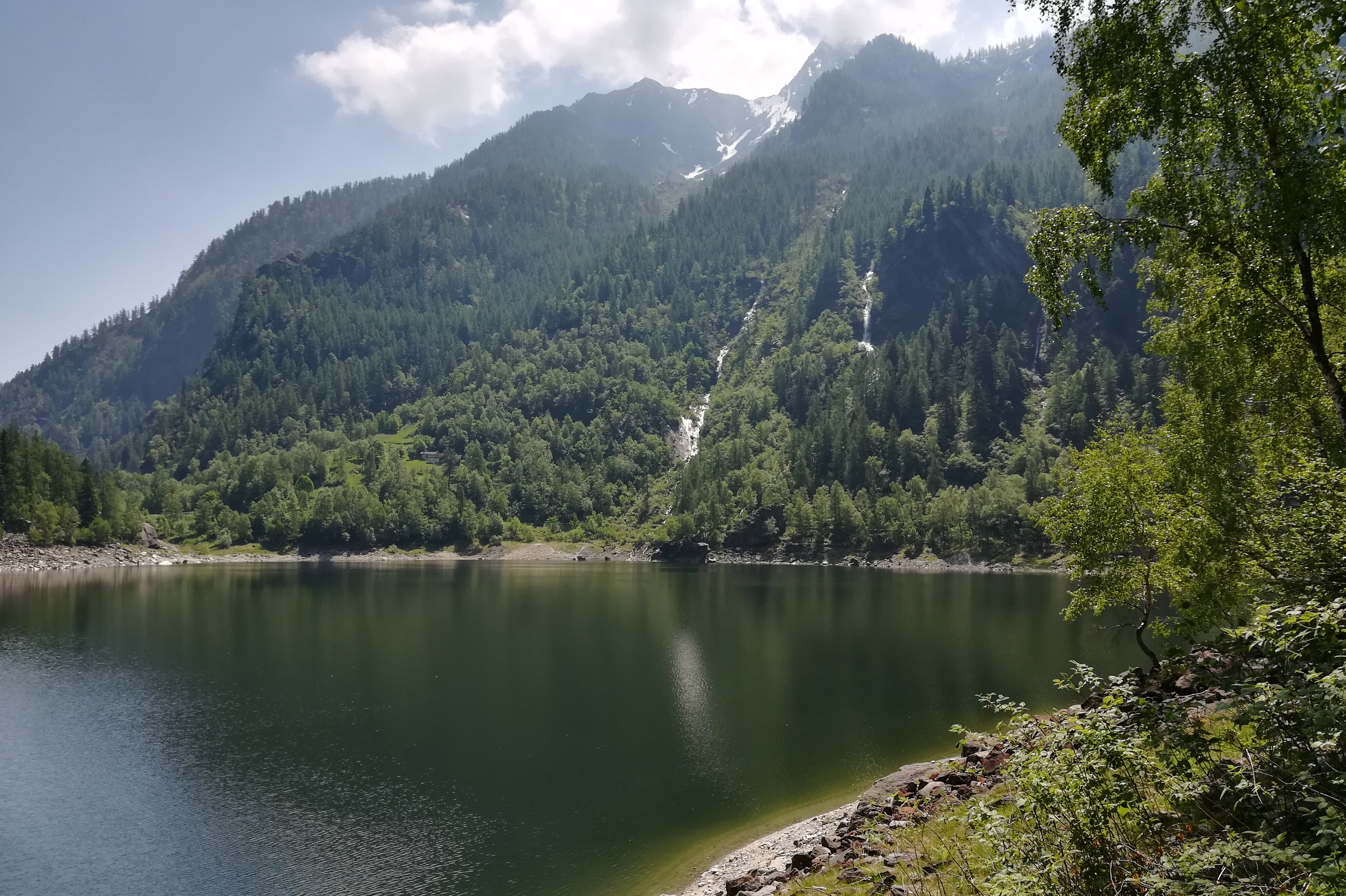
It is a ring route that allows you to discover a natural lake that was originated on July 27, 1642 by a landslide of enormous proportions (12 million cubic meters) which detached itself from the left side of the valley (Cima di Pozzuoli). The mass of rock covered the entire valley for over 2 km, up to the gates of the town of Antronapiana. The route features a stretch equipped with suspended walkways that allows the passage behind the wonderful waterfall of Brook Sajont.
The route:
From the square of the Church of Antronapiana take the paved road towards Lake Antrona and just beyond the skating rink take the marked path C00 (Strada Antronesca) which reaches Alpe Cimallegra and then cross the road again. Shortly after, take the path towards Acqua Bona that crosses the large accumulation of landslide colonized by a dense forest. Near a brook, in a clearing of grass and moss, there is a comfortable wooden seat that invites you to lie down to listen to the sounds of nature. The path continues until you take the paved road that leads to Antrona Lago; then, skirting the lake, it goes up passing behind the waterfall of Brook Sajont and goes down almost to the edge of the lake. Take the path to Alpe Ronco which leads to the intersection of the paved road, follow it until you cross the Strada Antronesca traveled uphill and soon return to Antronapiana.
Area: Antrona Valley, Alta Valle Antrona Natural Park.
Notable Items along the Track
Alta Valle Antrona Natural Park
POUT_ACCESSO_LABEL
By train: Domodossola station, Ferrovie dello Stato. Timetable: http://www.trenitalia.com/; www.rail.ch. By bus: bus to Antronapiana, Domodossola - Antrona line. Timetable: www.vcoinbus.it By car: A26 motorway towards Gravellona Toce, from here SS33 del Sempione, Villadossola exit towards Valle Antrona until you reach Antronapiana.
link-utili-label